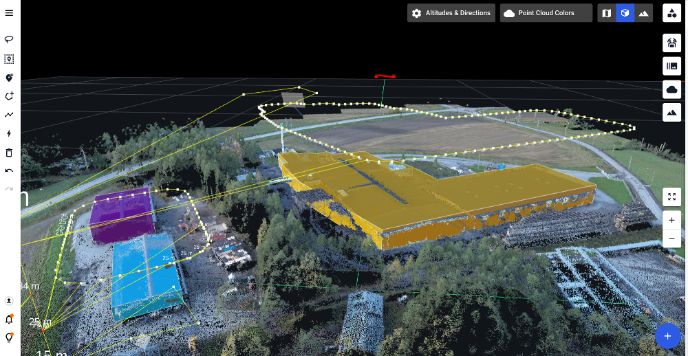
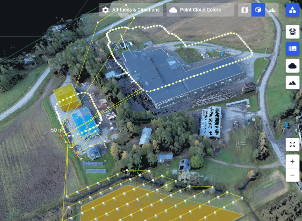
Want to follow terrain of a hill. Unpractical to launch from the base of the hill.
I have the elevations on the hill - complied to KML file. But - will NOT allow me to go lower then 4 feet from the launch point - which is from the top of the hill.
I can only image that I am not the only person who would use this feature - Any one trying to explore a canyon, Mountain side, or flying into a pit! . . .
This would certainly be a useful feature for me. I want to map walls of an open pit mine and need to be able to fly below the take-off point. We have quite accurate DEM's so as long as the flight plan stays above the DEM I cannot see any reason why this could not be possible.
Ist dies Funktion jetzt schon in der Basic Version möglich oder nur in der Plus Version. Ich finde dies auch sehr nützlich und würde es begrüßen, wenn es möglich wäre negative Werte einzugeben.
Negative altitude flight plans are not yet supported. We know that many users are asking for it. It has implications on a lot of our code -> we ask for patience here.
Yes certainly this would be logical and more functional for most flying circumstances, being able to fly terrain following elevations below the drone take-off point, where that point may be on the top rim of a quarry or open-pit mine, or hill top. Having to find the lowest point in a survey area for take off may not be practical or convenient.
Want to follow terrain of a hill. Unpractical to launch from the base of the hill.
I have the elevations on the hill - complied to KML file. But - will NOT allow me to go lower then 4 feet from the launch point - which is from the top of the hill.
I can only image that I am not the only person who would use this feature - Any one trying to explore a canyon, Mountain side, or flying into a pit! . . .
Attachments Open full size
This would certainly be a useful feature for me. I want to map walls of an open pit mine and need to be able to fly below the take-off point. We have quite accurate DEM's so as long as the flight plan stays above the DEM I cannot see any reason why this could not be possible.
Attachments Open full size
I can't believe this feature is not even planned in the DH's road map oO
I use to work with DH only few time, because my job is to inspect bridge and some clifts... and most of the time I'm from the up...
Anyway, Martin please this feature keep some of your customers away... it's a basic need for a many drone operators.
Attachments Open full size
Ist dies Funktion jetzt schon in der Basic Version möglich oder nur in der Plus Version. Ich finde dies auch sehr nützlich und würde es begrüßen, wenn es möglich wäre negative Werte einzugeben.
Attachments Open full size
Negative altitude flight plans are not yet supported. We know that many users are asking for it. It has implications on a lot of our code -> we ask for patience here.
Attachments Open full size
Danke für die Auskunft, es wäre wirlich eine sinnvolle Erweiterung.
Attachments Open full size
Yes certainly this would be logical and more functional for most flying circumstances, being able to fly terrain following elevations below the drone take-off point, where that point may be on the top rim of a quarry or open-pit mine, or hill top. Having to find the lowest point in a survey area for take off may not be practical or convenient.
Attachments Open full size
And also the altitude of the POI should be possible to set to negative values...
Attachments Open full size
We the majority of our data collection in (high-)alpine terrain - this feature would be invaluable for us - please add!
Attachments Open full size